Blånebba
Romsdalen & Eikesdalen Average
Blånebba is a relatively short and easy trip but with an amazing view.
From the parking lot you take southwest (right from parking if you have your nose pointing to the top) through the forest and take direction to the ridge of Blånebba. Be sure to have the stream on your left side when you get above the tree line. Then it is only to continue north west and aim at the lowest point on the ridge between Blånebba and Mjølvafjellet. Its's getting queit steep the last bit up to the ridge, around 1100 altimeters, so it is possible for avalanches to start there. When you're up on the ridge, just follow southeast towards the top. Up there you have a great view of Store Venjetind, Trollveggen, Romsdalen and, of course, the clear blue fjord.
Down is the same way as up. If there are good snow conditions and you like steep skiing then you can take the north face from the top.
Starting point:
The parking at Venjedalssetra. Follow sign to Venjedalen when on road 177 in Isfjorden. The last part of the road you need to pay 70 NOK.
-
Toppen och ryggen på Blånebba

Photo: larchii
-
På "platten" mellan trädgränsen och branten upp mot ryggen på Blånebba. Store Venjetind i bakgrunden.

Photo: larchii
-
Ryggen och toppen på Blånebba. Vid sol och påskledigt är det många som stannar och fikar innan sista biten ska avverkas.

Photo: larchii
-
Toppen med Trollväggen i bakgrunden.

Photo: larchii
-
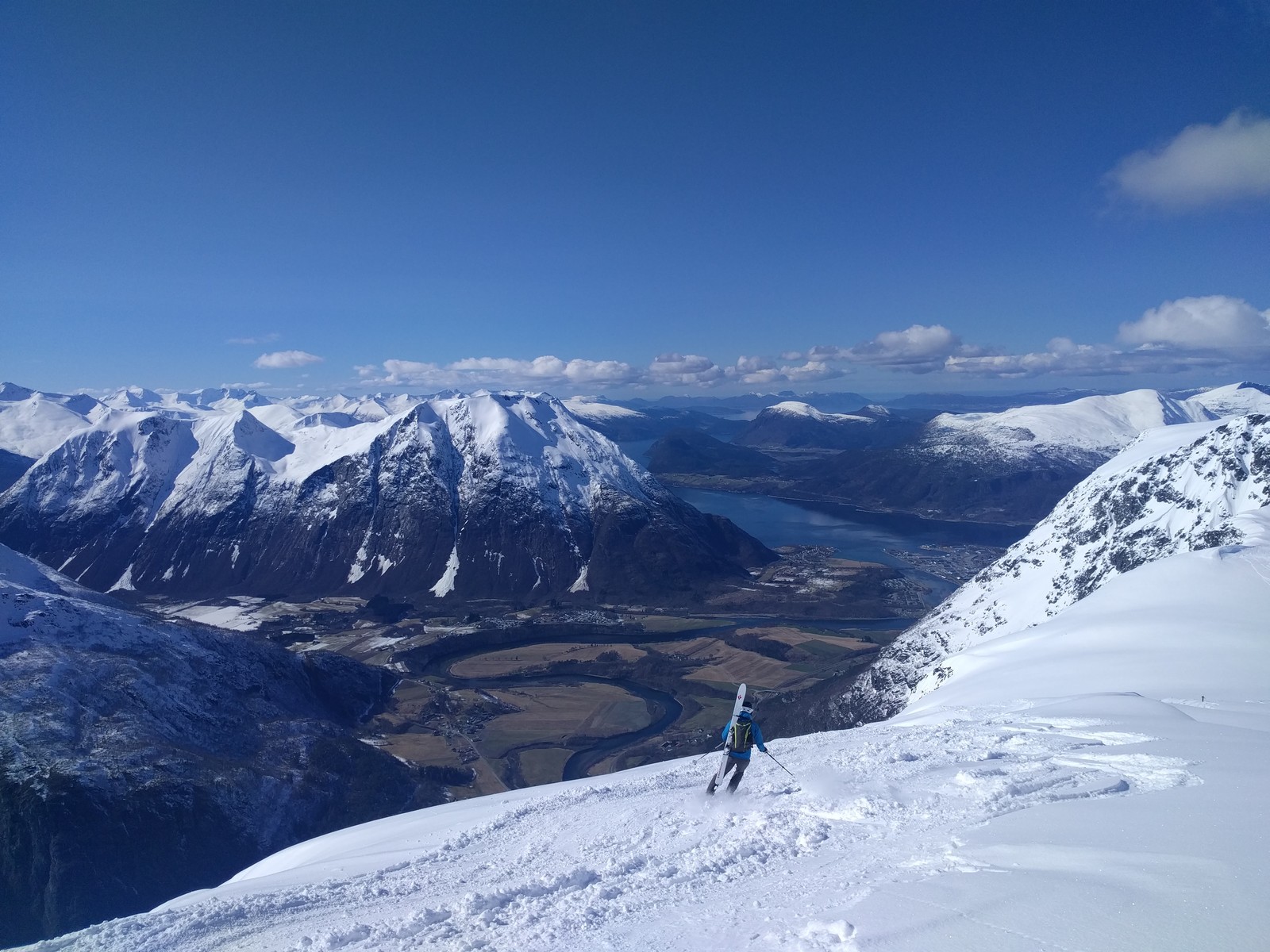
Nedförsåkningen längs ryggen bjuder på skaplig utsikt.

Photo: larchii


| Region: | Romsdalen & Eikesdalen |
| Highest point: | 1320 m.a.s.l. |
| Lowest point: | 284 m.a.s.l. |
| Vertical drop: | 1036 meter |
| Length: | 4000 meter |
| Time consumption | To get to the top: 2 hours - 3 hours |
| Difficulty level: | Average How does the scale work? |
Sept
Okt
Nov
Dec
Jan
Feb
Mar
Apr
Maj
Jun
Jul
Aug

You ski outside controlled areas at your own risk. Use and practice with your safety equipment. Inform yourself about the current, local conditions. Hire a mountain guide for better and safer skiing at the summit and backcountry. Have fun on the mountain and the courage to turn around when the risks are too great. Safe turns!
Pictures from Blånebba
Nearby
| Kvasstinden | 12 km |